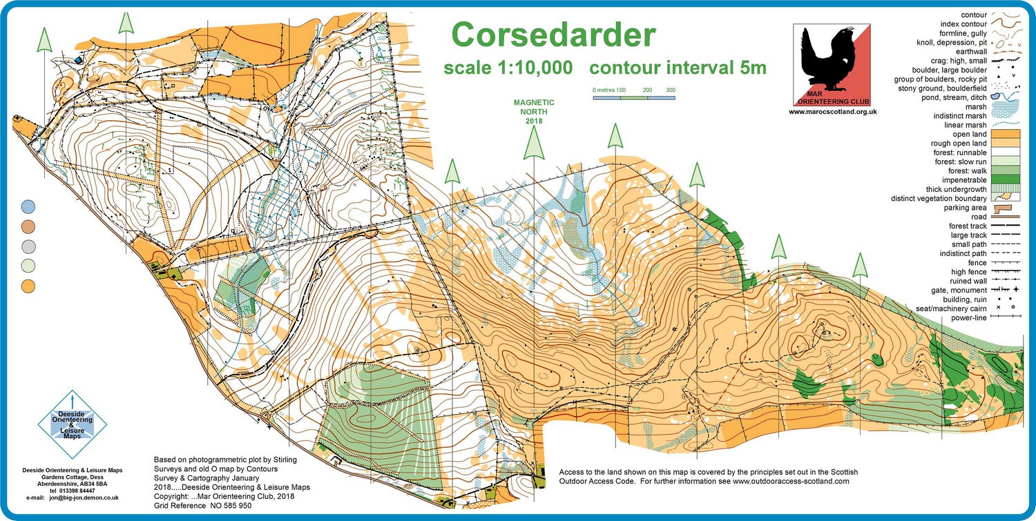
Skip to Navigation | Skip to Content

Mar Orienteering Club

  • Home
  • News
  • Events
  • Results
  • Maps
  • Junior
  • Photos
  • Membership
  • COPE
  • Coaches
  • Resources
  • Contacts

Corsedardar

Corsedardar map

Near: aboyne

Terrain

Hilly woodland on the raod between Aboyne and Finzean

Share on Facebook

Location

map

Nearest town: aboyne

  • Grid Ref: NO 586 949
  • Postcode: AB34 5EA
  • Latitude: 57.039516
  • Longitude: -2.662983
  • Google Map
  • Streetmap (OS)
  • Bing Map (OS)
  • OpenStreetMap

Other Maps

Allt Cailleach

Ballogie

Balnagowan

Bellwood

Birse

Birsemore

Bogendreip

Cambus O’May

Coull

Creag Choinnich

Dalliefour

Dess

Glen Davan

Glen Feardar

Glen O’Dee

Glen Tanar

Inchmarnoch

Inver

Muirton Woods

Pannanich

Potarch

Redburn

Shooting Greens

Sluie

Tilquhillie

Wood of Easter Clune

© 2021 Mar Orienteering Club

Built by PF Web |  Login